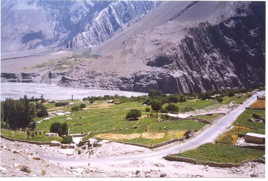
HUSSAINI
Hussaini Village is situated in Hunza valley, 145 km North of Gilgit and 45 km from Ali Abad in Central Hunza. Hunza River flows in to the east while the Karakoram Highway (KKH) passes to its west.
Hussaini Village is situated on 74*.54' and 03" East longitude to 36*.26' and 53" North latitude at an altitude of 2556 meters (Source-GPS) above sea level.
South of Hussaini is Gulmit (the headquarters of Gojal magistracy - tehsil), Ghulkin is to the southwest, while Passu is in the north with famous Batura glacier. Hussaini glacier is located to the west with famous Shisper peak, 7611 meter.
|
ALI REHMAT MUSOFER
MSc Geography
DEPARTMENT OF GEOGRAPHY
URBAN AND REGIONAL PLANNING
UNIVERSITY OF PESHAWAR
|
Hussaini is a small village of Gojal (Upper Hunza) in the Northern Areas of Pakistan. It is situated on the both banks of Hunza River. The old main village is on the western-bank and at the lateral moraine of Hussaini glacier and below Borith Lake. The newly irrigated land, called Zarabod, is on the left bank. The total population is 545 souls, living in 75 households. (Field survey-20000)
see Report for more detail.
MSGIS
JOIN...Mountain Sciety of Geographic Information Systems MSGIS
http://groups.yahoo.com/group/MSGIS/ |
E-mail:
alimusofer@yahoo.com |